Evidence that Two Sheds were Different Sheds
The purpose of this page
is to present evidence that unequivocally
proves that a small machinery shed built in 1989
was a different shed from a large shed
built and used as a dwelling nine years later.
The two sheds differed in size, shape and location.
In order to present the evidence that establishes the facts
in the public interest,
it is necessary to display photographs of the property,
thus identifying the property.
The street name and the registered plan number
and lot number of the property are given here
to ensure that anybody
who wishes to independently investigate the facts is able to do so,
but the street address number is not revealed here.
Serious Issues
A local council (Wondai Shire Council)
incorrectly decided that two sheds
that differed in size, shape and location
were one and the same shed.
There are serious issues associated with this deliberate error.
Some of these issues are described in the page about
unapproved dwellings
in this website.
Even the Queensland Ombudsman,
which took years to investigate the error
and appears to have always unquestioningly accepted WSC's lies,
was eventually compelled to accept the evidence.
Despite this, the Ombudsman still refused to correct WSC's error.
Lot 6 RP197617 is a 65 acre block located at Shellytop Road near Durong.
A small machinery shed, open on one side,
was constructed there in 1989.
Nine years later, in 1998, a new owner
built a larger shed as a dwelling on the crest of a ridge
approximately 200 metres from the machinery shed.
No building permit for the dwelling was obtained.
The machinery shed was demolished.
The unapproved dwelling was used as a residence from approximately 1998
until approximately 2009.
The building that was used as an unapproved dwelling still exists
(as at November 2019).
SBRC (South Burnett Regional Council)
superseded WSC in 2008.
SBRC appears to follow exactly in WSC's footsteps.
Aerial Photographs
The diagram below shows where the 1989 machinery shed used to be
and where the unapproved dwelling was built in 1998.
Aerial photos are not reproduced here for copyright reasons,
but the diagram below is a fair representation of the sizes,
shapes and locations of the sheds visible in aerial images.
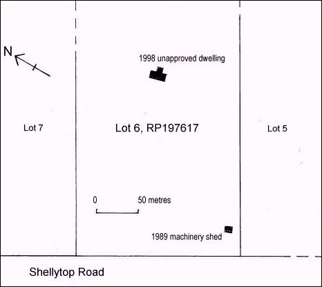
Plan map of part of Lot 6 RP197617,
showing the size, shape and locations
of a 1989 machinery shed
and a 1998 unapproved dwelling.
Data used in the preparation of the above map was gleaned
from a commercial
aerial photo taken in 1996 by a Queensland government department,
and from aerial photos available courtesy of
google maps.
The commercial aerial photo can be purchased
from the Queensland Government.
Reference information for the image is film number QAP5515,
run number 7, frame number 112, date 02 October 1996.
The southwest half of Lot 6 RP197617
should be selected at a high level of magnification.
(Queensland government departments keep changing their names
and website links soon become broken,
so any readers who are interested will have to do their own searches
to find the website of the current Queensland department
that deals in aerial photography.
As at July 2015, the relevant department was called
the Department of Natural Resources and Mines.)
Other aerial photos taken after 1998 show
the later of the two sheds,
but aerial photos taken from late 1999 onwards
do not show the earlier of the two sheds.
Ground-Level Photographs
Several ground-level photos match precisely with the two sheds
that are visible on aerial photos and marked on the above map.
The photos below were all taken from a similar spot in the middle
of the roadway at Shellytop Road.
A sufficiently wide area is displayed to enable comparison
of landscape features to be made between photographs that were
taken years apart, thus removing any possibility of doubt
that all the photos are of the same area.
January 1998
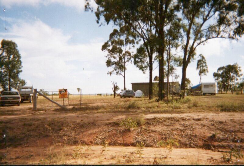
This photo taken in January 1998 shows a small machinery shed
that was constructed in 1989.
The size and location of the shed match precisely
with the image of a shed in a state government aerial photo taken in 1996.
This shed did have a building permit.
There is no shed on the crest of a ridge in the middle distance.
January 2001
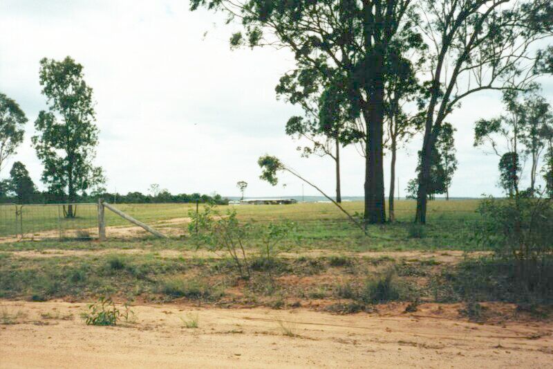
This photo taken in January 2001 shows that the machinery shed no longer exists.
A larger shed is now visible on the crest of a ridge in the middle distance.
It was constructed in 1998 and it still exists.
The size and location of the shed match precisely
with the image of a shed in aerial photos taken after 1998.
This shed did not have a building permit, but it was used
as a residence for many years.
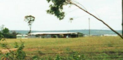
An enlarged view of the unapproved dwelling in January 2001.
Electricity was connected to the shed shortly after it was constructed.
The power pole is visible.
August 2010
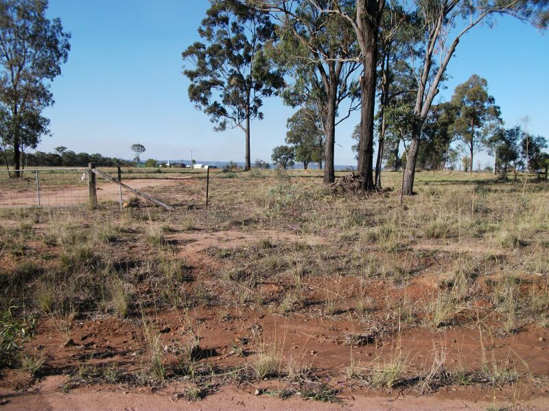
This photo was taken many years later in August 2010.
The shed that had been used as an unapproved dwelling
is still visible on the crest of a ridge in the middle distance.
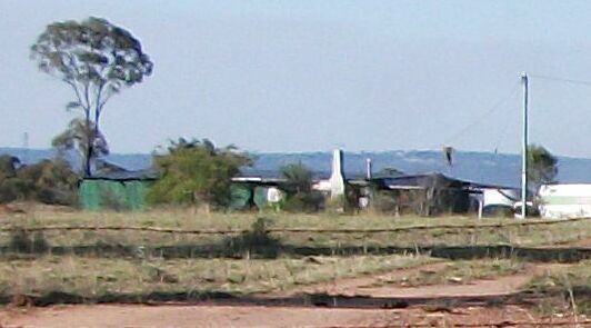
An enlarged view in August 2010 of the shed
that had been used as an unapproved dwelling.
The colour scheme has changed since 2001.
A chimney stack is visible.


